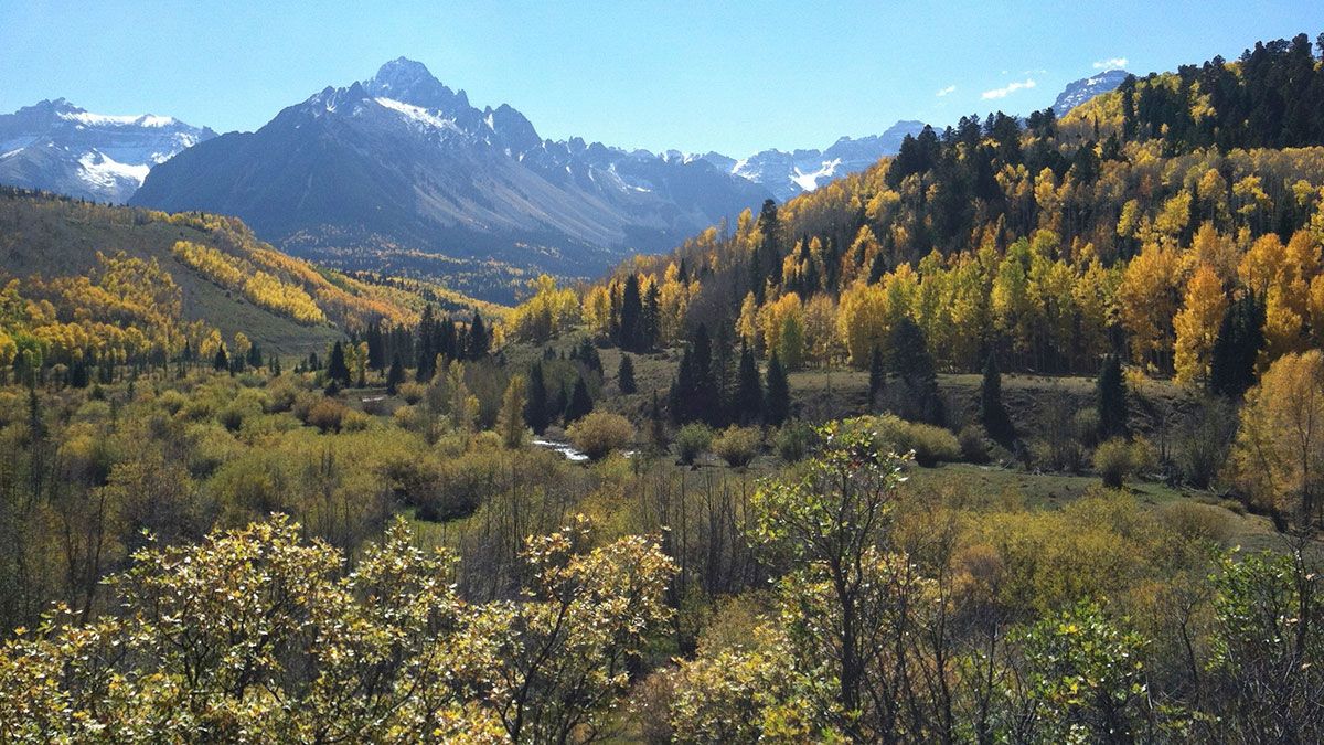
Mount Sneffels

Trail Details
| Round Trip | 4.0 miles |
| Starting Altitude | 11,700ft |
| Highest Point | 14,150ft |
| Elevation Gain | 2,450ft |
| Round Trip | 7-8 hours |
NOTE: Mount Sneffels is a CLIMB--not a hike!
TRAILHEAD:
STANDARD ROUTE: Drive south on Hwy 550 from Ouray and just after the first switchback, turn right onto the Camp Bird road (County 361). Keep left to take the higher bridge over the Uncompahgre Gorge. At about 4.6 miles from 550, stay right at the turnoff for the Camp Bird Mine. It is not advisable for large cars to go beyond this point. The road to Imogene Pass goes left 0.6 mile from Camp Bird. Ahead to your left, you will soon see the ruins of the Atlas Mill; across from it is space for Parking beside the road. This is a good stopping place for cars with two-wheel drive. At a fork 2.2 Miles from Camp Bird, the road to Yankee Boy Basin goes right; Govenor Basin is to the left. The road beyond is safe only with high-clearance 4WD vehicles. If you are driving beyond the fork, Parking spaces can be found after about 0.8 mile. A toilet facility is located here. Farther on, Parking is possible along several side roads or spurs. This land is fragile--please park only on firm bare ground to avoid more loss of plants and flowers.
At about 0.5 mile beyond the toilet is the last side road going left (south), and the road begins a steady climb. After 0.3 mile, the road may be closed to vehicles by a chain, depending on the season and road conditions ahead. There is a turnaround just before the closure.
ATTAINING THE SUMMIT:
Starting from the trailhead, you cannot see Mt. Sneffels until you are up in the high basin; Kismet is often mistaken for Sneffels. On the trail from Wright's Lake, you will reach a junction where the Blue Lakes Trail goes left to the Pass; turn right for 1/8 mile east to a cairn at the Sneffels turnoff going north.
If you approach Sneffels by the road, instead of the trail described above, the road ends after a mile. Continue on the trail heading toward the Blue Lakes Trail Pass. Go a half-mile to the cairn marking the Sneffels turnoff to the right.
From the cairn, the goal is the saddle between Sneffels (left) and Kismet (right). At the saddle, check the weather again since you can now see to the north. If conditions are beginning to deteriorate, this is a good place to consider waiting for a better day.
From the saddle, go left (northwest) up a steep narrow gully or couloir, which may have snow it it. Climb nearly to the top of the couloir where a notch opens to the left. Observe the location of the notch for your descent. You will come out on a ridge which leads you up to the summit. The final stretch of 650 feet requires some proficiency in minor rock climbing--and caution.
Be aware of rocks rolling from above and be careful not to dislodge any yourself. Do not linger on the summit--leave time to descend with care. Falls are more dangerous coming down.
ATTRACTIONS AND FEATURES:
This striking 14,150 foot mountain is an inviting destination for many visitors and a successful ascent can be most rewarding. It must be emphasized, however, that this peak has produced fatalities, serious injuries and hazardous rescues. It requires more planning, preparation and skill than the trails described on this website.
Mt. Sneffels is not a Colorado "fourteener" that can be summited by following a hiking trail. The upper part of the mountain, in the best circumstances, requires scrambling on steep slopes with loose rock, and much of the year requires ascending a steep couloir where an ice axe is essential.
SPECIAL PRECAUTIONS:
Before attempting the climb: * Review "Be a Wilderness Survivor", particularly items 1, 2, 3, and 6, on the FAQ page of this website. This data is provided by the Mountain Rescue Team, and is very valuable information for all hikers. * Talk to local climbers about conditions and the advisability of carrying ice axes and other gear. Refer to a guidebook for more information. Avoid climbing on holidays and weekends. * Be certain that all party members are well conditioned, acclimated and experienced. Practice on the higher trails, ascending to over 11,000 feet, described herein. * Start early and watch the weather! Afternoon storms are common; lightning is a serious hazard; snow is possible in any month.- Hits: 28154